
EXTREME WESTERN RING OF PEAKS
CENTRAL AND WESTERN MASSIFS
- Type of activity
Trekking
- Meeting place
- Duration
- Kilometers
- Unevenness
- Number of People
- Difficulty
EXTREME WESTERN PEAK RING - CENTRAL AND WESTERN MASSIFS
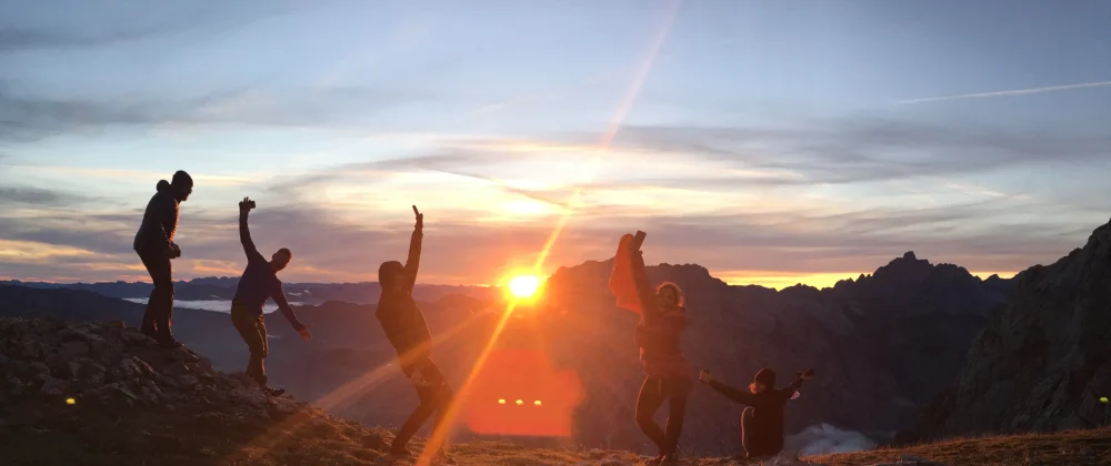
The Extreme Ring of Peaks takes place in the Western and Central Massifs of the Picos de Europa National Park. It's one of the most challenging treks you can do on the Iberian Peninsula and a must-have for any mountain lover.
We'll start in Poncebos, heading towards the Western or Cornión Massif, which gave rise to the National Park and boasts the most varied landscapes. We will make some modifications to the itinerary marked by the Ring of Picos, to give it the Picos Outdoor seal and improve it, passing through places that we consider must-see such as the Canal de Trea, the Lakes of Covadonga, the Ordiales Viewpoint, the Vegabaño Forest or the Valdeón Valley, among others, to move on to the Urrielles Massif or Central Massif of the Picos de Europa, located between the valleys carved by the Cares and Duje rivers, undoubtedly the wildest, the one with the greatest slopes and where the highest and most representative peaks of the National Park are located, such as Torrecerredo, the highest altitude of these mountains and of the entire Cantabrian Mountains with 2,648 meters or the Picu Urriellu (Naranjo de Bulnes), a true symbol of the Asturian mountains and the National Park and a place where, since its conquest in 1905, the most beautiful pages of mountaineering in the Iberian Peninsula have been written. It is in this massif where these mountains reach their maximum expression, with an unsurpassed high-mountain environment, concentrating a large number of peaks in a relatively small area, unmatched in any other mountain range on the peninsula, where there are other higher mountains, but not as rugged and inaccessible.
For six days, we'll travel from refuge to refuge through the most iconic and beautiful spots in the Picos de Europa National Park, on a challenging but unforgettable trek that's a must-have in your backpack.
Trekking Itinerary
On our first day of trekking, we will depart from Poncebos Bridge (218m), to do a stretch of the famous, popular and spectacular Cares Route, one of the most impressive gorges in the world, until reaching the detour to the demanding Trea Canal, that we will ascend to reach the Vega de Ario Shelter and enjoy its stunning views of the Massif Central and Western, as well as the magnificent food and exceptional service from its staff. In Vega de Ario, we'll spend our first night of the trek.
Distance: 16 km. Elevation: +1,540 m – 489 m
On our second day of trekking, we will descend towards the Lakes of Covadonga (1,100m), to visit this magnificent place, and then ascend to the Vegarredonda Shelter (1,410 m), where we will spend our second night. A beautiful day that passes through symbolic locations in the Picos de Europa, such as the lakes themselves and the Pozo del Alemán, a place named after Roberto Frassinelli, an exceptional pioneer of the Picos de Europa. Crossing meadows and valleys, we enter the Western Massif until we reach the Vegarredonda Refuge, where we will spend our second night.
Distance: 14 km. Elevation: +1,040 m -835 m
During this long and hard day, we will take one of the most classic routes of the Massif, crossing it from North to South, through the characteristic karst landscape of the high altitudes of Los Picos de Europa, where the chaos of limestone rock reigns between jous and passes, making orientation difficult. This is a good day to see chamois, a characteristic animal of the National Park. During this classic route, we will be accompanied by the highest peaks of the Massif, passing through Vega Huerta to enjoy the impressive South Face (600 meters high) of Holy Rock of Castile, the highest point of the Cornión mountain range at 2,596 metres. From this valley, from which we can also enjoy beautiful views of the Massif Central, we will descend through the Frade pass towards the Vegabaño Shelter (1,320m), located in a magnificent place surrounded by beautiful forests, to enjoy a well-deserved rest after a long and hard day.
Distance: 16 km. Elevation difference: +1,170m – 1,270m
A beautiful and tough day, in which we will enter the Central Massif, and which will take us from Vegabaño to the beautiful valley of Valdeón, and from there, overcoming a significant slope, reach the Collado Jermoso shelter (2,046m). We will head to the Dobres pass to descend into the beautiful Valdeón Valley. From the village of Cordiñanes, we begin the ascent, entering the Asotín beech forest, which will take us to the Vega de Asotín, a beautiful and spectacular place. From here we will ascend through the gorge to the Collado Jermoso refuge, located in one of the most spectacular and beautiful spots in the entire National Park. Situated on the edge of a cliff and surrounded by the rugged peaks of the Llambrión group, opposite the spectacular Friero Tower, and with magnificent views of the Valdeón Valley and the Cornión Massif, with Peña Santa always standing out. Despite the tough day, everyone will be pleased to stay in such a place.
Distance: 18 km. Elevation: +1,450 m -880 m
This day will take place in the high altitudes of Massif Central, rarely reaching altitudes below 2,000 metres. After crossing jous, mountain passes and a chaotic sea of limestone, we will head towards the most popular refuge in the Picos de Europa, located at the base of the most emblematic peak of the National Park, the Picu Urriellu, and at its most spectacular, its impressive West Face, over 500 metres high, a true benchmark for Spanish mountaineering. An unforgettable place, both for its beauty and its symbolism.
Distance: 8 km. Elevation: +870 m -985 m
We left the Urriellu refuge to head towards Cabrones shelter, the base of the mountain range where Torrecerredo, the highest peak in the entire National Park, is located at 2,648 meters. We will then head, passing another emblematic peak, Cabrones, towards the refuge of the same name, where we will stamp our passports. All that remains is a long and steep descent from the Cabrones refuge (2,030 m) to Poncebos Bridge (218m)We will go down the slope of Trave and the Amuesa Canal to reach the beautiful town of Bulnes (648m), inaccessible by vehicle and only reachable by the Tejo canal or the Pandébano pass until the construction of a funicular from Poncebos. From Bulnes, we only have to descend by the Tejo Canal to Poncebos, where we will end our beautiful and unforgettable adventure.
Distance: 18 km. Elevation: +685 m -2,296 m
Scheduled departures
- June 9-14, 2025
What the trekking includes
- Mountain Guide Service with AEGM-UIMLA accreditation.
- Five nights of accommodation in shelters.
- Five half-boards (dinner + breakfast) in the shelters.
- Peak Ring Passport.
- Collective safety material.
- Accident and liability insurance.
What the trekking does not include
- Transport.
- Any other concept not mentioned as included.
To take into account
- At the shelters you can buy a picnic for each day, avoiding carrying heavy items.
- There are blankets in the shelters. A light sleeping bag or a sleeping bag sheet is sufficient.
- The route may be subject to changes depending on weather conditions, shelter availability, and/or other circumstances, always keeping the safety of the group in mind.
- Group of 4 to 8 people.
- Picos Outdoor only obtains benefits from the guiding service.
EXTREME WESTERN RING OF PEAKS
CENTRAL AND WESTERN MASSIFS- Accredited expert guide
- Groups of 4 - 8 people
- Accident and liability insurance


